土地资源作为人类的劳动对象和赖以生存的基本资料,对社会发展有着不可替代的重要意义,长期以来,我国一直面临着人多地少、土地资源匮乏的国情[1].人口城镇化减少了对农村居民点用地的需求,但农村建设用地粗放的发展模式和环境问题的集中爆发,使得农村人口减少的情况下居民点用地总量不减反增,土地污染和浪费严重,耕地的质量和数量不断下降[2],土地资源形势不容乐观.中央农村工作小组为此专门提出了科学划定农业、城镇等各类空间和生态保护红线的“乡村振兴战略规划”.
农村居民点用地整理对促进土地的优化配置和开发利用、保护和修复具有重要的现实意义,在相关研究中,国内外学者的关注角度有所不同.国外学者Olivia J[3]、W. Fleming[4]等认为居民对土地整理的支持度是实施土地整理重要评价指标之一; Musisi Nkambwe [5]、Demetris D[6]等则分别利用土地利用预测模型、土地资源调查、GIS工具等,对计划进行居民点整理区域的土地面积和环境状况、土地资源管理效果以及用地适宜性进行了分析研究.国内学者在关注民意[7]、国家政策[8]以及相关技术[9]对农村居民点用地整理的影响基础上,通过对我国不同自然环境区域、不同经济发展条件下的农村居民点整理潜力测算及现实整理潜力修正的研究认为:不同区位及环境条件下农村居民点整理的最适宜的评价方法有所差异,居民点用地整理受人口变动、社会经济条件、自然环境状况等因素的影响程度也大不相同[10-11]; 经济发达地区的经济发展条件、规划及相关政策对农村居民点整理影响较大,而地形地貌等自然环境条件影响相对较小[12]; 农村居民用地整理影响因素评价指标体系中除自然、社会、经济因素外,农居点的利用因素也占重要比重[13].总的来说,经济发达地区的土地整理研究要多于落后区域,但就整理难度和迫切性看,经济落后地区的农村居民点用地更为迫切、整理难度更大.此外,上述部分研究中虽对地理信息系统(GIS)有所应用,但多限于数据存储与空间表达,对GIS的数据管理与计算、空间分析、决策支持等功能应用较少.
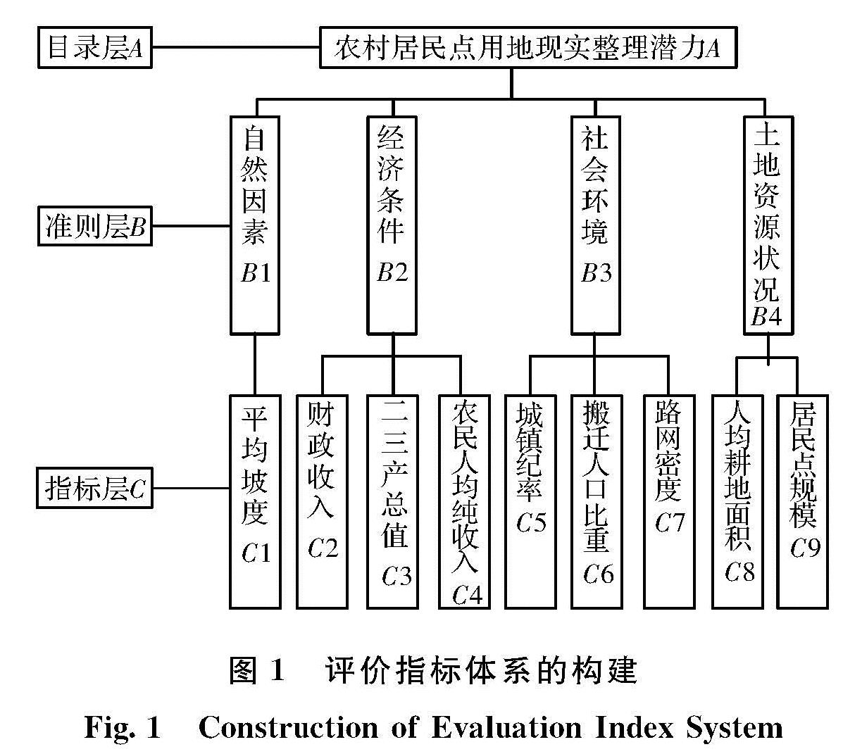
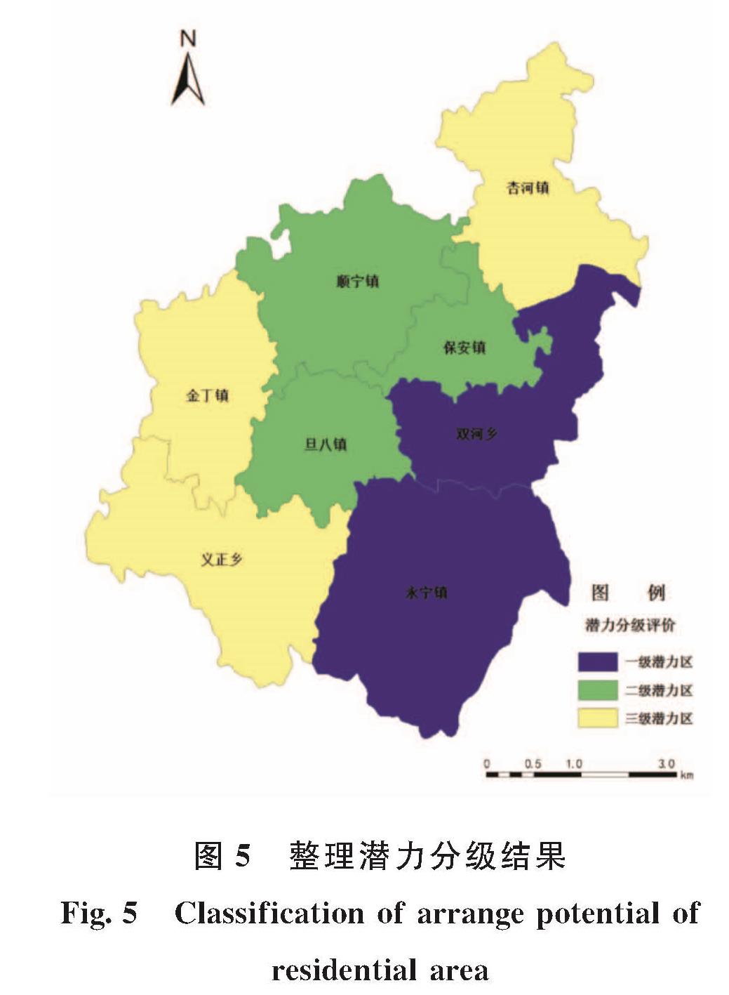
黄土高原作为地球上黄土区分布最集中的地区,总面积64万km2,缺乏植被保护和雨季暴雨冲刷使得该地区水土流失严重、生态环境脆弱[14],居民点用地及其他建设用地增加,人地关系紧张程度加剧.志丹县作为黄土高原中西部,黄土丘陵沟壑特征明显,农村居民点用地整理工作开展较早,但整理效果不够显著.本文以GIS技术为基础,以志丹县为案例研究对象,通过建立农村居民点用地整理修正模型以及进行县域农村建设用地现实整理潜力的分级与分区,对农村居民点用地整理进行潜力测算评价,以提高农村居民点用地整理的科学性和可操作性,进而为整个黄土高原地区农村居民点用地整理提供借鉴和指导.